CILLITEC UAV-DRONE

CILLITEC UAV-DRONE

giovedì 16 ottobre 2014

3D-printed UAV now sports ducted fan motors


3D-printed UAV now sports ducted fan motors


It may look like a flying manta ray, but this is actually the University of Sheffield's la...

It may look like a flying manta ray, but this is actually the University of Sheffield's latest UAV

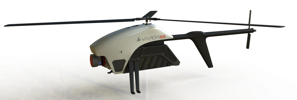
Image Gallery (2 images)
Back in April, we first heard about a 3D-printed UAV airframe that could be fabricated within 24 hours. Created by a Boeing-assisted team at the University of Sheffield's Advanced Manufacturing Research Center, it was a gliding prototype that would require the addition of a motor and an external propeller for powered flight. Its recently-announced successor, however, features integrated electric ducted fan motors.

As with its predecessor, the modular components of the new blended-wing UAV were made largely via Fused Deposition Modeling (FDM). This is the type of 3D printing in which successive layers of molten plastic are extruded one on top of another, to build up complete objects.

Although the aircraft consists of separate modules that are bolted together, the central body – which houses the fan motors and incorporates "complex internal features" – was printed as a single ABS plastic part. The motors and electronics themselves were added afterwards.

Members of the AMRC Design and Prototyping GroupUAV team, left to right: Sam Bull, Mark Co...
While some other components were made from carbon fiber this time around (it presumably now takes a little longer than 24 hours to build), those parts were still made using 3D-printed molds. As an added economical bonus, those molds were double-sided, allowing one piece of plastic to be used to create two parts. One of those carbon parts is a moveable "duck tail," which facilitates improved pitch control by channeling the air as it comes out of the ducts.

The finished UAV weighs 3.5 kg (7.7 lb), puts out 2.5 kg (5.5 lb) of combined thrust, cruises via remote control at nearly 72 km/h (45 mph), and is launched using a custom-made catapult. It can be seen in flight in the video below.

Plans call for the next version to have a twice-as-wide 3-meter (9.8-ft) wingspan and miniature gas turbine engines. It may also incorporate unique flight control surfaces, and carbon composite batteries that are part of its structure.

Sources: University of Sheffield, AMRC paper


fonte :3D-printed UAV now sports ducted fan motors

martedì 14 ottobre 2014

3DR Releases the New Aero-M & X-8M Mapping Platforms


3DR Releases the New Aero-M & X-8M Mapping Platforms


3DR’s Aero-M and X8-M are fully automated and intelligent tools: drone mapping platforms for easy, fast and accurate aerial data acquisition that will enable you to take informed and targeted action. They provide a level of insight that’s invaluable to industries like agriculture, construction, mining, and land and resource management, or for gathering data for any area that needs to be looked at closely and often. They allow you to get this data cheaper, easier, quicker, with less risk and more frequency and detail than manned flight or satellite imagery.
Our mapping drones come bundled with a high-resolution Canon SX260 visible-spectrum camera, but the payload system is interchangeable so you can swap your own cameras or sensors for shooting IR, hyperspectral or other imagery. The package also includes Pix4D professional image-processing software, a version developed specifically for the 3DR platform by Pix4D, the leading image post-processing company.

Our three-step workflow is fully automated: Plan, fly, process. Select the area you want to map, and the drone computes the flight path that will cover it. While in flight, onboard software automatically captures all the right photos for you and geo-tags where each one was taken; takeoff and landing are also both automated, with built-in flight protections like Return-to-Land. Finally, our custom Pix4D post-processing software stitches these photos into a crisp, high-resolution map, down to an amazing one cm/pixel, depending on the height of your flight. Zoom in from the sky down to the grape.
Additionally, you can save and repeat any flight with as much frequency as you need, and you can compare and overlay that data across time.

Imagine the advancements you might make if you could get accurate and immediately actionable information about your land as frequently as you want. You’ll see more, see better, and save money, and once you see your operations from the air you’ll never approach work the same way again. There are two options for included Pix4D software, designed specifically for 3DR mapping platforms. Capabilities include creating 2D maps in the Standard version, and the Pro version can also create index maps (e.g., NDVI) in a single workflow, perfect for crop stress differentiation. In addition, you can “fly through your map” in a software-generated 3D movie, complete with waypoints. And we’ve made all of this available at a price up to five times less than that of our nearest competitor, which will revolutionize the commercial UAV industry.

Image processing for our mapping platforms is powered by Pix4D, the leading provider for professional UAV processing software. The Pix4Dmapper software included in your package is a complete and fully automatic mapping and modeling solution that can convert and join thousands of images into highly accurate geo-referenced 2D mosaics. The software can also generate fly-through animations from original images in asingle workflow. The software is suited to beginners as well as professional photogrammetrists: Create the project and get results with one click.
A Pix4Dmapper Pro upgrade is also available for 3DR mapping platform customers. With Pix4Dmapper Pro 3DR Edition users are enabled to exploit full 3D capabilities as well as agriculture specific tools. The Pro version can generate point clouds, digital surface and terrain models, create vector objects (polylines, surfaces, stockpiles) and create index maps (e.g. NDVI).


fonte:omiga-plus

giovedì 9 ottobre 2014

RIEGL - Single news

RIEGL launches the RiCOPTER Unmanned Aerial System!


(07.10.14)
We, RIEGL are presenting an impressive display at INTERGEO. Both at RIEGL's indoor booth A3.014 in hall 3.1 as well as in the outdoor area at booth FG.002 new revolutionary products are being unveiled.
We are excited to announce the release of the RiCOPTER! Therefore we are the first major LiDAR manufacturer to develop its own unmanned aerial system. The RiCOPTER is a high-performance UAV equipped with the RIEGL VUX-1 survey-grade LiDAR sensor to offer a fully integrated turnkey solution.


Stop by the RIEGL booth to see the VUX-1 integrated into several other UAS systems, such as SARAH by Flying-Cam or Aeroscouts UAS, demonstrating the versatility of the instrument! Moreover live demonstrations of RiCOPTER will be performed Tuesday - Thursday in Intergeo’s UAV flight zone.
We are also launching a brand new airborne LiDAR system. Come by our booth to see the new VQ-880-G, a fully integrated turnkey LiDAR solution for topo-bathymetric surveying applications.
On the terrestrial side, we are adding a new terrestrial laser scanner to our portfolio. The VZ-2000 is RIEGL's fastest terrestrial laser scanner. It comes with a 1MHz pulse repetition rate and up to 400,000 effective measurements per second, with range performance of more than 2,000 meters. The VZ-2000 is a great surveying tool for both static as well as mobile mapping with the VMZ hybrid mobile mapping solution.
In addition to all of the new hardware that we will have on display at INTERGEO, there are also several software introductions. RIEGL is releasing the RiSCAN PRO 2.0, a major update to RiSCAN PRO with significant improvements and new 64-bit architecture.
Learn more about other significant software improvements directly at the booth.
We are looking forward to welcoming visitors to its booth A3.104 and FG.002 at INTERGEO this year!


fonte:RIEGL - Single news

giovedì 2 ottobre 2014

Pulse Aerospace® Announces VAPOR 55TM

Pulse Aerospace® Announces VAPOR 55TM

vapor55
Pulse Aerospace, Inc. has publicly announced the release of its newest rotorcraft, the Vapor 55TM UAS. This all-new helicopter is a larger and more capable cousin to the company’s Vapor 35TM electric unmanned helicopter.  Pulse’s new offering boasts an impressive safety feature set, a precision full-authority automatic flight control system, and the same easy to operate, touchscreen compatible ground control station as Vapor 35TM. The Vapor 55TM carries a 12 lb., front mounted sensor for up to 60 minutes on a single charge. Larger payloads can also be carried. Both the Vapor 35 and 55 utilize automatic rotor speed calibration for altitudes from sea level to over 10,000ft AMSL.
The Company reports that it has already sold several Vapor 55TM systems, including directly to the United States Navy and commercial corporations within the U.S. Payload options include survey-grade airborne lidar and next generation high definition EO/IR brushless gimbals.
The Vapor 55TM was conceived to provide unprecedented ease of use for commercial, industrial, and security applications requiring larger payload suites below a 55 lb. gross takeoff weight. Industrial, agriculture, security, remote sensing/inspection, and aerial photography markets all have immediate needs for the improved efficiencies. “Pulse’s rotorcraft design and optimization technologies enable the rapid development of platforms that carry best in class payloads that are applicable in each of these markets,” explains Aaron Lessig, Pulse’s CEO. “Pulse is aligning with service providers looking to take advantage of our technology in serving their customers abroad, while preparing for the US market. Pulse will continue to leverage its intellectual property to expand its technology portfolio into markets requiring heavy payloads, precise automatic positioning, and endurance.” Beyond the electric rotorcraft’s class leading payload/endurance numbers, the Vapor 55TM is well suited for tactical use due to the system’s small footprint, superior reliability, and safety in real-life environments without modification to the vehicle. Vapor 55TM is priced to be relevant for commercial and industrial use.
“We are seeing serious service providers wanting to hit the ground running as the U.S. commercial market begins to open. Operators want to reliably carry a broader array of instruments for longer periods of time, “commented Lance Holly, Pulse’s Vice President of Engineering. Pulse’s technical advantages have allowed the company to compete very strongly for applications requiring robust automatic flight control, low-level flight, hovering or vertical takeoff, and with Vapor 55TM, carrying sensor payloads up to 24 lbs. Pulse is dedicated to developing best-in-class unmanned helicopters, and says it will continue to focus on industries where superior operational and sensor performance are critical.
About Pulse Aerospace®
Pulse Aerospace® is the premier developer of helicopter Unmanned Aircraft Systems (UAS) technology in the United States. Pulse’s HeliSynthTM technology brings dynamics, control, payload, and endurance capabilities historically limited to high cost military vehicles, to commercially relevant price points and systems. Pulse’s leadership has served military, commercial, university, and non-military government VTOL UAS customers for nearly a decade. Pulse’s technical advantages are recognized in both light and heavy payload applications using traditional helicopter designs that are more scalable than other vehicle configurations.
For further information about the company or its products, please contact Mr. Aaron Lessig aaronlessig@pulseaero.com .


fonte:Pulse Aerospace® Announces VAPOR 55TM | sUAS News